
Reviewed onTripAdvisor Note : 5, Excellent.
Information
What's available
Viewed products
-

4 days motorbike in...
4 Days motorbike tour in the Alps :...
-

Motorbike Week-end on...
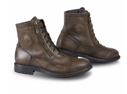
Rent your motorbike and spend your...


More info
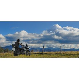
At the start of Annemasse and Geneva, route 4 days riding.
Drive through the French Alps from north to south and from south to north!
Day 1
Distance: 288 km
Travel time: 5:37
Day 2
Distance: 288 km
Travel time: 5:04
Day 3
Distance : 264 km
On the road : 5h19
Day 4
Distance : 289 km
On the road : 5h50
Day 1: (see on Google Maps)
Pick up of the rental motorcycle at Annemasse railway station, then towards Bonneville.
Arrived at Bonneville, you take the direction of La Clusaz in the "Gorges des Eveaux".
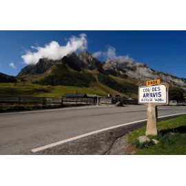
We cross the Col des Aravis (1486 m), and we go in the direction of Beaufort.
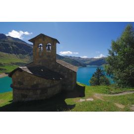
We pass the lake created by the dam of Roselend, and the Cornet de Roselend (1967 m). So it goes in the natural park of Vanoise.
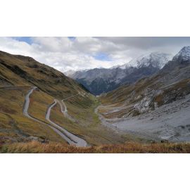
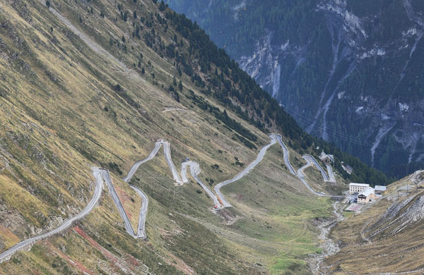
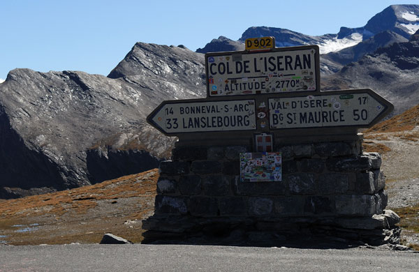
We let Bourg-St-Maurice to our right and continue towards the Barrage de Tignes and Val d'Isère, before climbing the Col de l'Iseran (2764 m).
In the descent, we take a left towards the Col de Mont Cenis (2084 m), and continues along the lake of the same name. It crosses the border between France and Italy.
Arrived at Susa, we go toward south-west to Cesana Torinese for the night.
Tourist Office Cesana Torinese
Piazza V. Amedeo 3
10054 Cesana Torinese
Tel: 00 39 12289202
www.turismotorino.org
info.cesana @ turismotorino.org
Day 2: (See on Google Maps)
Leaving Cesana Torinese to return to France in the direction of Briançon.
From Briançon direction of the Col d'Izoard (2360 m). We cross and the Natural Park of Queyras, direction Guillestre, the Combe du Queyras.
We continue towards Vars, and we cross the Col de Vars (2109 m)
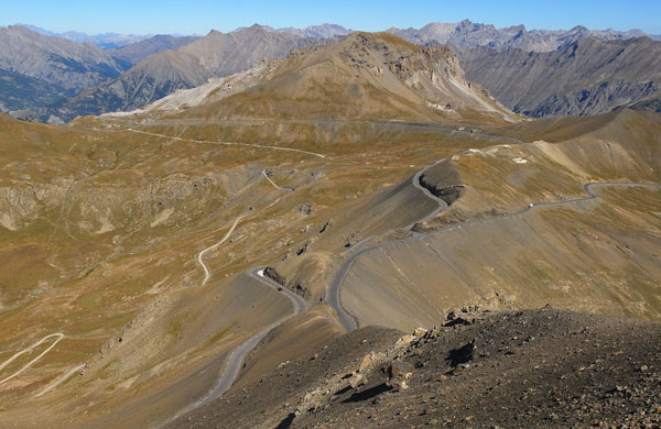
It then enters the natural park of Mercantour, for the ascent of the Col de la Bonnette (2715 m). At the pass, you can take the road that goes around the Bonnette summit. Culminating at 2802 m is the highest paved road in France and in the Alps.
We continue our descent to the south by St Martin Vésubie.
Heading south-east towards the Turini forest and the famous Col de Turini. This route is taken almost every year by the Monte Carlo Rally, and has many bends and beautiful views over the Mediterranean.
It then descends to the south towards Sospel and Menton, where the days ends, right on the Mediterranean. Attention in season, book early for accommodation.
Menton Tourist Office: www.tourisme-menton.fr, tel: 04 92 41 76 76.
Day 3: (see on Google Maps )
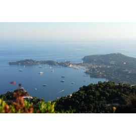
We leave Menton along the coast on the hills towards the west. It bypasses Monaco, to back down Nice and take the Promenade des Anglais.
It then goes on to Grasse.
It then follows the route Napoleon towards Castellane and Digne-les-Bains.
You can stop at Castellane near the roundabout Marcel Sauvaire place to spend some quality time for a lunch or a drink.
A Digne-les-Bains, you can take the D900A left, parallel to the D900 from the site of the Vélodrome, the largest geological reserve in Europe.
We continue towards the Lac de Serre-Ponçon, which runs along the east side.
It stops in Guillestre. House Tourism Guillestrois: www.pays du guillestrois.com Tel: 04 92 45 04 37
Day 4: (see on Google Maps)
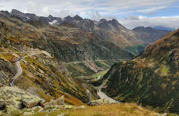
Leaving Guillestre towards Briançon. We start then the Lautaret pass (2058 m) and the Galibier (2646 m).
Then we return to St-Michel de Maurienne, St Jean de Maurienne.
After St Jean de Maurienne, it goes towards the Col de la Madeleine (1993 m), to get to Albertville.
We then joined the Lake Annecy via the Col de Tamie.
It runs along Lake Annecy Talloires through.
We pass near the center of Annecy, take the opportunity to take a walk in the old town.
It then goes on Cruseilles, then mounted on the Salève, where we will have a view of Mont Blanc and Geneva and its lake.
Back to Annemasse.
Updated 27/07/2011
Copyright Moto-Plaisir .fr AMG Sarl. All rights reserved.
Note to the users : The road books are given for information only. Indications may be modified at all times or not exact. It is of the responsibility of the user, to check weather and road conditions, and to be sure of his own ability to drive on such roads.
Safety rules and traffic regulations must be respected.
Moto-Plaisir.fr will not be liable for any direct, indirect, incidental, special or consequential damages that result from the use of or inability to use the road books.